Civic surveillance transparency
See where automated license plate readers watch public roads.
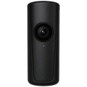
DeFlock is a crowdsourced map of ALPR cameras — including Flock Safety and similar vendors — that are visible from streets, sidewalks, and other public spaces. Know what is in your community. Verify what neighbors report. Keep the record honest.
- Public map
- User verified
- No live GPS stored
- 18+ · lawful use only
2cameras mapped
0confirmed present
0field verifications
5registered contributors
Our mission
Automated license plate readers quietly became part of everyday street furniture. Poles, trailers, and brick-sized cameras photograph vehicles, extract plate numbers, and feed searchable databases used by police, private companies, and sometimes homeowners associations. People drive past them for years without a public inventory. DeFlock exists so that residents, journalists, researchers, and local officials can see where ALPR infrastructure sits in public view.
This is a transparency tool, not a takedown campaign and not a crime map. We document cameras that can already be seen from public spaces — the same way a newspaper might photograph a new cell tower or a traffic signal. Locations of objects in public view are not a secret, and describing them is constitutionally protected speech in the United States. We still take care: we do not publish license plate numbers, we do not map people, and we do not help anyone interfere with equipment.
Every pin starts as a neighbor’s report. Color tells you how much the community has checked it. Green means multiple recent confirmations. Yellow means the record is thin or getting old. Gray is new. Red means people say it was removed or the report is disputed. Treat the map as a lead, then look with your own eyes.
Our commitment
We collect the minimum personal data needed to keep the map from being gamed. Email is stored encrypted. Live location stays in your browser until you choose to submit a report or a verification. Nearby activity is shown as an anonymized heat grid, not as a dot on a person. Fingerprinting, if used, exists only to slow duplicate accounts and ban evasion — and we say so in the privacy policy.
We will not sell personal data. We will honor lawful deletion requests. We will comply with lawful process while minimizing what we keep. We will suspend accounts that use DeFlock to stalk, harass, trespass, or vandalize. The community’s right to know does not include a right to harm.
DeFlock is operated for educational and journalistic purposes. Camera positions are approximate. Always verify independently. Do not trespass. Do not touch or obstruct cameras. Follow every local law that applies to you.
How DeFlock works
1. Spot
If you see an ALPR from a public road — a Flock Safety pole, another vendor’s reader, or a unit you cannot identify — take a photo, drop a pin, and send it in. Email verification is required. Phone verification is optional and only increases the weight of your later votes.
2. Verify
When you are within about 100 meters, you can confirm the camera is still there, report that it was removed, or say you cannot tell. Removals need a photo. We reject backdated claims. Your standing on the platform changes how much the algorithm trusts the vote.
3. Decay
Infrastructure moves. Confidence falls as reports age. If a pin stays weak for months, we hide it so the map does not pretend to be more current than it is. Fresh eyes keep the record alive.
Why ALPR transparency matters
License plate reader networks can reconstruct where a car has been, when it passed a corner, and which other vehicles traveled nearby. Agencies buy or lease these systems faster than public debate can catch up. Contracts, data-retention rules, and sharing agreements are often scattered across city packets, sheriff budgets, and vendor marketing pages. A map does not replace those documents, but it gives people a place to start: there is a camera on this block.
Journalists use location inventories to file records requests. Neighborhood groups use them to ask elected officials what data is stored and for how long. Drivers use them to understand the landscape they already move through. None of that requires trespass. None of that requires reading a single plate. It requires a public, checkable layer of geographic fact.
Flock Safety is the vendor many communities notice first because the hardware is distinctive and the sales pitch is widespread. Other ALPR brands appear on the same map under “other ALPR.” Unknown units can be logged too, so the database is not limited to one company. The point is the capability in public space, not a brand war.
We also know maps can be misused. That is why the terms of service forbid stalking and harassment, why accounts can be banned, why we rate-limit reports, and why we run anti-abuse checks on impossible travel and copycat accounts. A civic tool still has to defend its integrity or it becomes noise.
Trust, without pretending we are a government database
DeFlock is not an official GIS layer from a police department. It is closer to a living notebook that many people edit in public. That is a feature when agencies will not publish coordinates, and a limitation when a pin is wrong. We show our work: verification counts, last-checked times, and status colors. If something looks off, open the pin, walk the block (from public property), and file an update.
New users can browse immediately. Contributing requires an email-verified account so we are not an anonymous graffiti wall. Higher trust — optional phone checks, a month of history, reports that others confirm — unlocks verification of other people’s pins. Moderators review flags. None of that makes us infallible. It makes us harder to spam.
Questions people actually ask
What is an automated license plate reader (ALPR)?
An ALPR is a camera system that photographs vehicles and software that reads license plates, often storing time, location, and travel history. Flock Safety and similar vendors market these systems to police departments, homeowners associations, and private companies. DeFlock maps installations that are visible from public spaces so residents can see where this infrastructure sits in their communities.
Is documenting Flock Safety cameras legal?
Photographing and describing objects visible from public streets is generally protected speech in the United States. DeFlock does not ask anyone to trespass, tamper with equipment, or interfere with public safety operations. Users must follow local law. Camera locations on this site are crowdsourced estimates, not official inventories.
How does verification work?
Contributors who are near a reported camera can confirm it is still present, say it was removed, or mark it as not found. Nearby GPS is checked in the browser at submit time. Claims that a camera was removed require a photo. Each vote is weighted by account trust. Older unused reports lose confidence and can be hidden.
Do you track my live location?
No. Your GPS stays in your browser unless you submit a report or verification. Nearby presence on the map is an anonymized heat grid, not a pin on a person. We keep the minimum data needed to stop spam and duplicate accounts.
Can this data be used to stalk or harass people?
No. The terms of service ban stalking, harassment, and other illegal use. Accounts that abuse the platform can be suspended or banned. DeFlock maps cameras, not people, vehicles, or plate numbers.
Is every marker guaranteed accurate?
No. This is a civic transparency tool, not a government database. Markers are color-coded by how many people have checked them and how recently. Always verify on the ground before you rely on a location.
Live transparency map
Pan and zoom. Colors mark how confident the community is. On a phone, use the radar control to see cameras within about a mile of you — GPS stays on your device until you submit.
Open full-screen map
Add what you see from the street.
Free to use. Built for shared hosting. No sale of personal data. Read the disclaimer before you contribute.
Get started
Legal notice